January was entirely taken up by our Epic Antarctic Expedition aboard the National Geographic Endurance.
Epic Antarctic Expedition
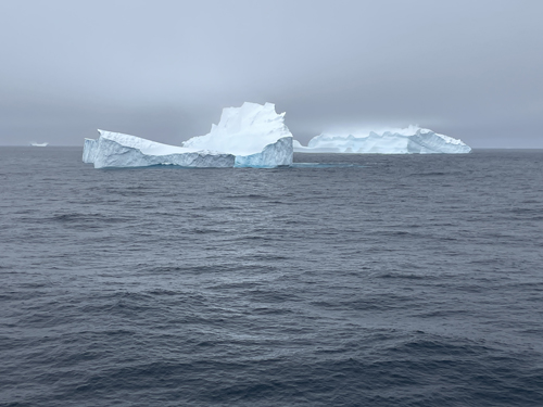
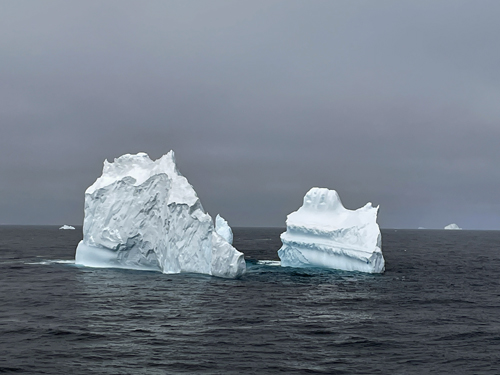
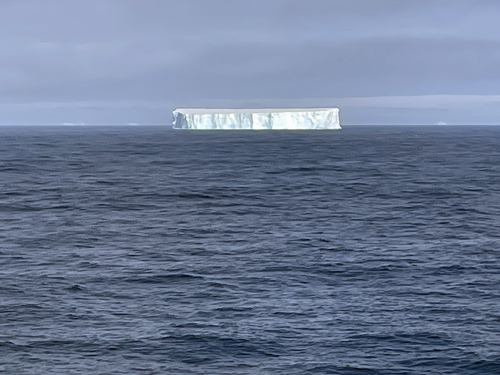
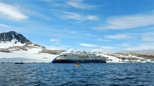
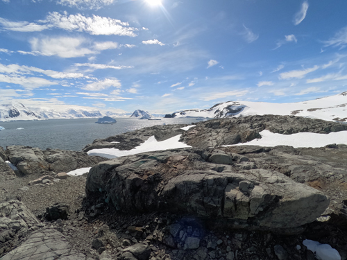
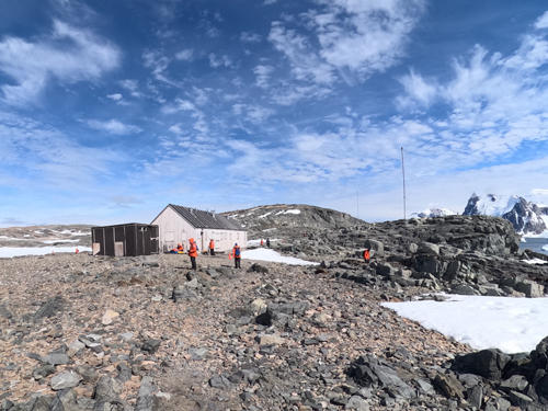
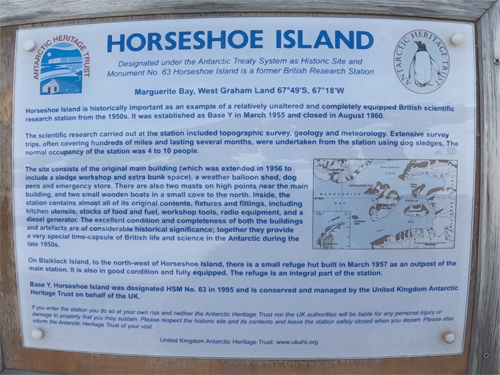
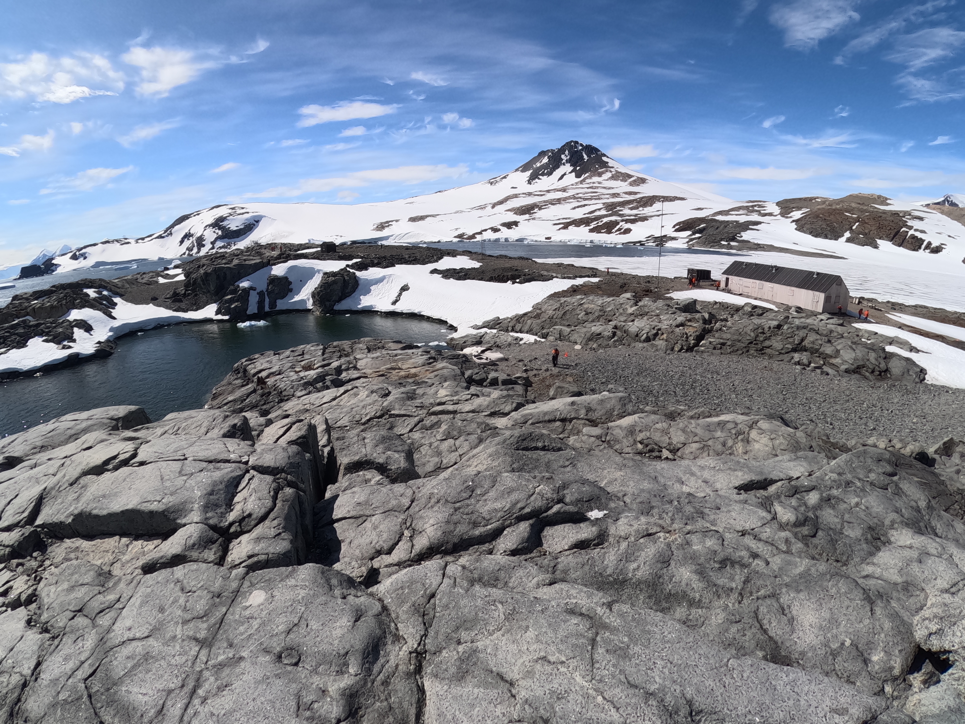
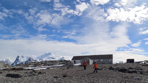
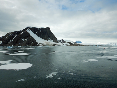
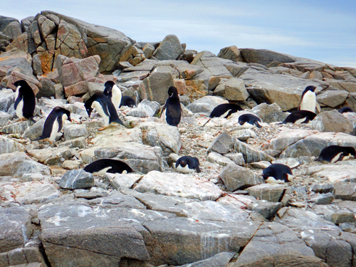
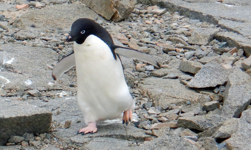
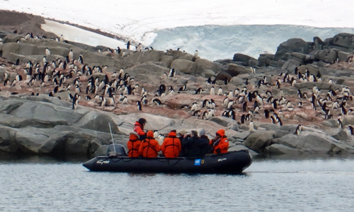
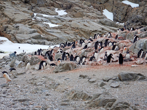
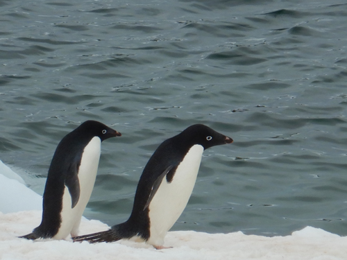
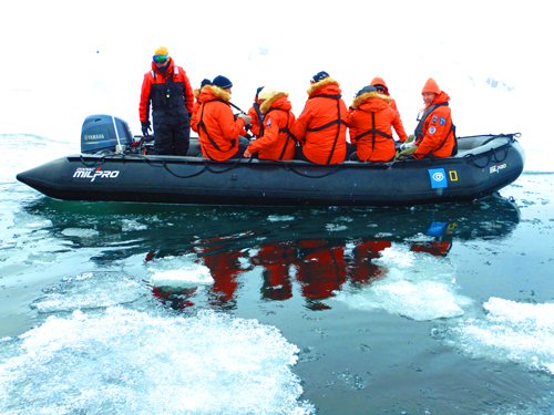
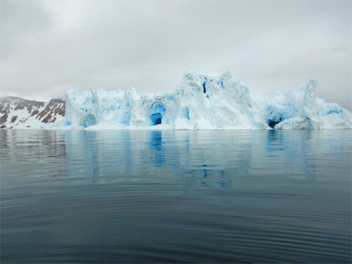
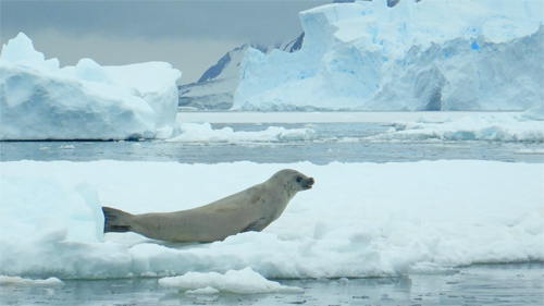
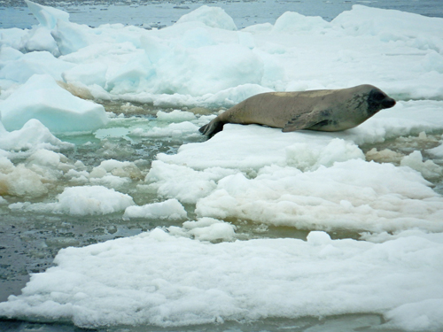
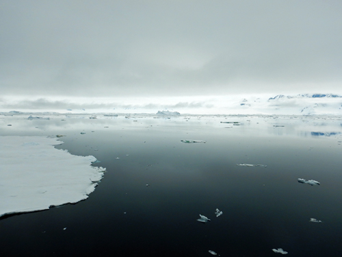
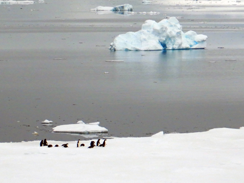
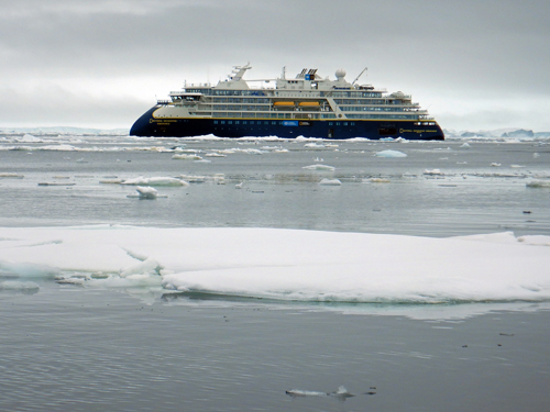
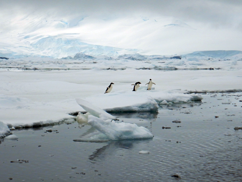
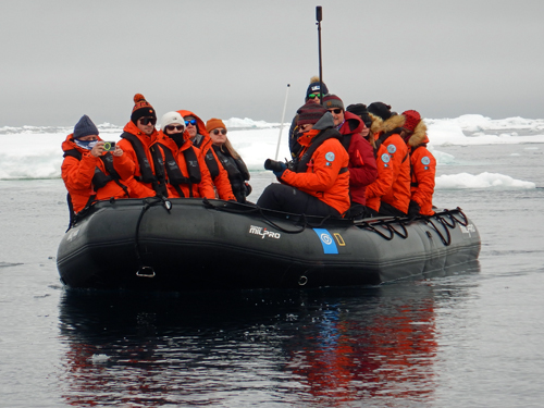
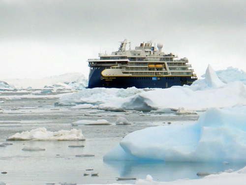
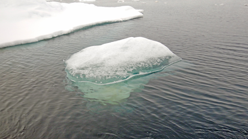
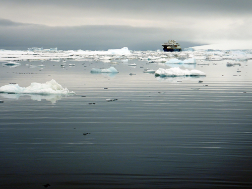
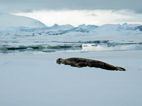
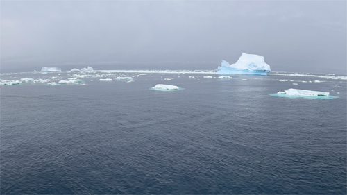
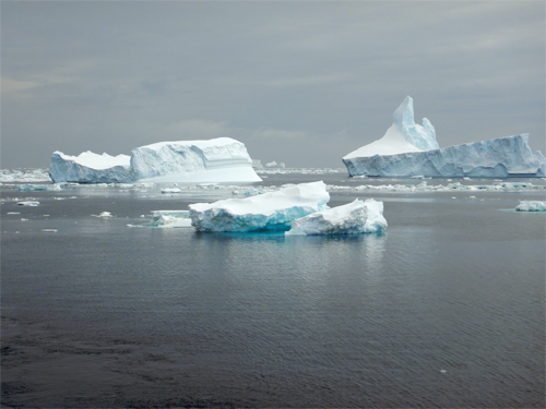
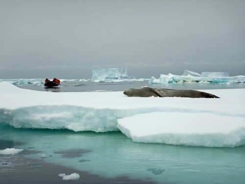
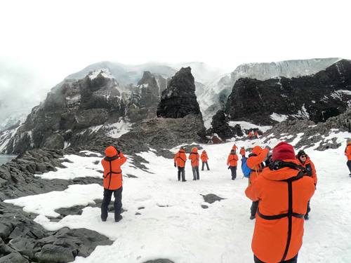
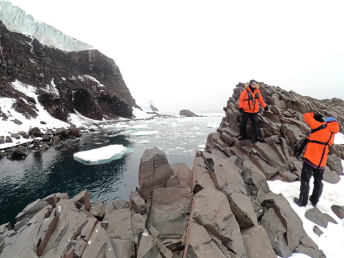
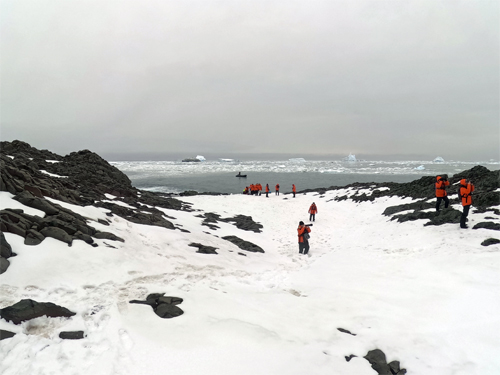
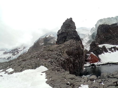
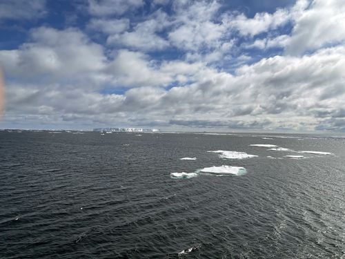
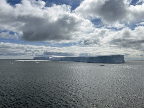
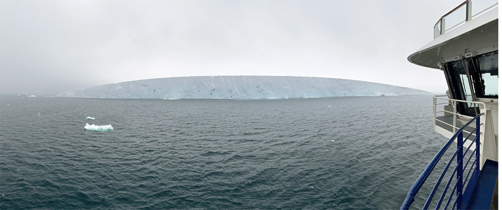
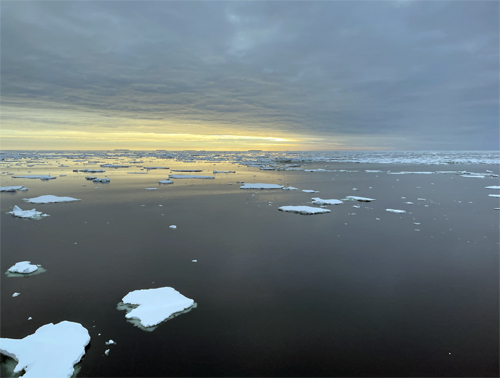
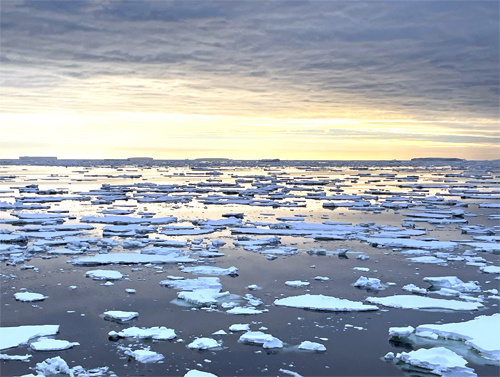
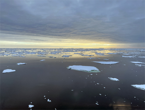
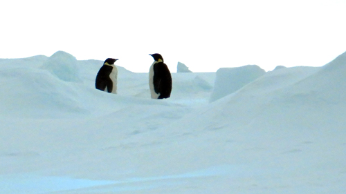
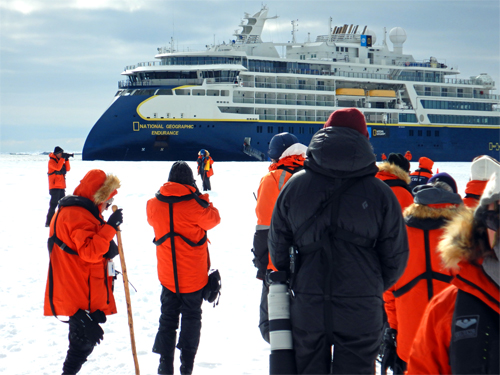
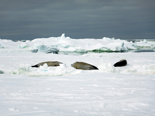
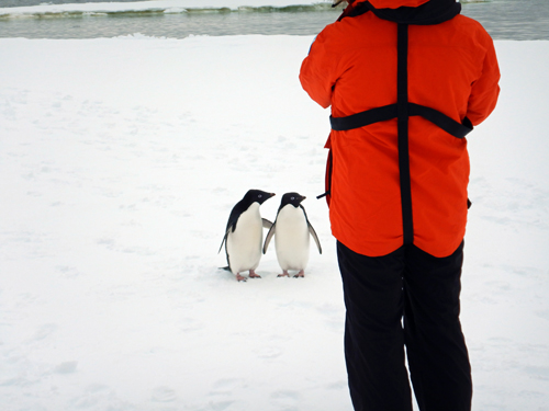
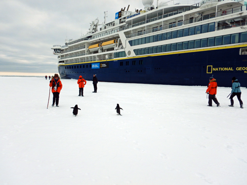
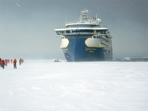
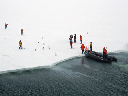
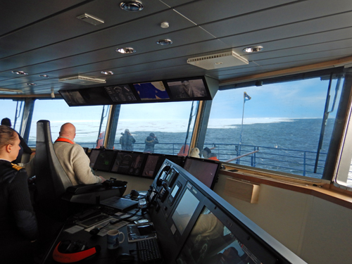
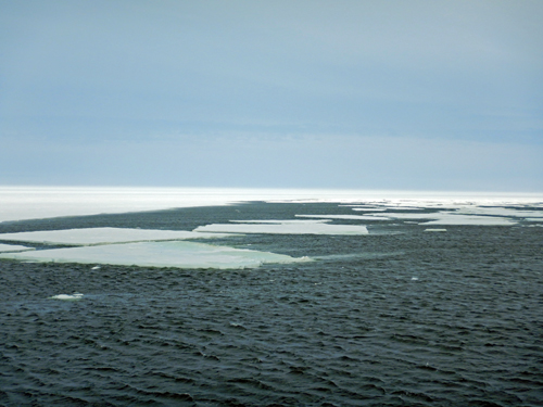
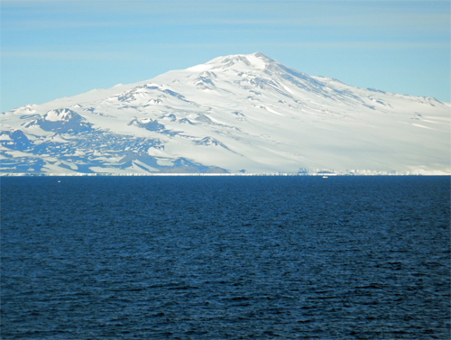
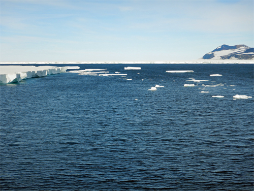
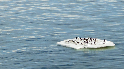
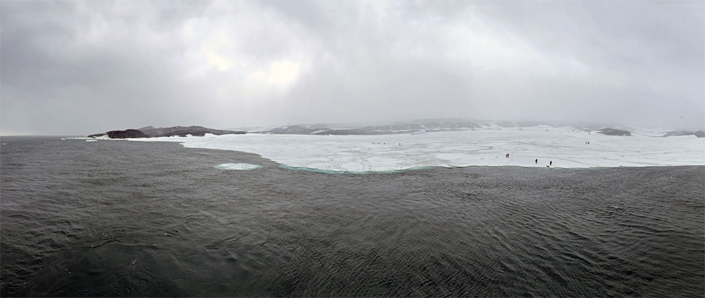
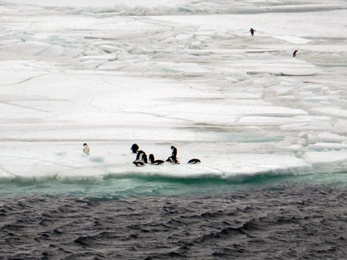
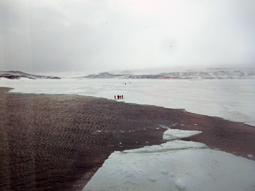
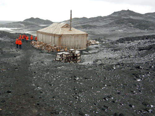
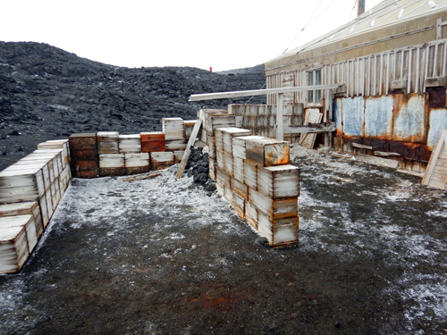
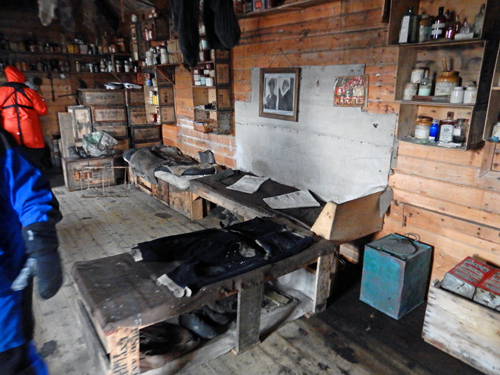
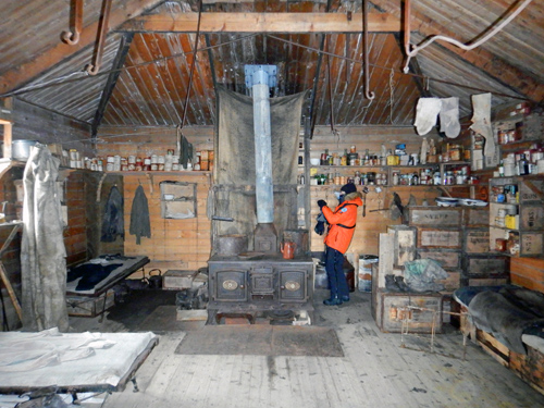
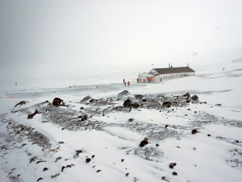
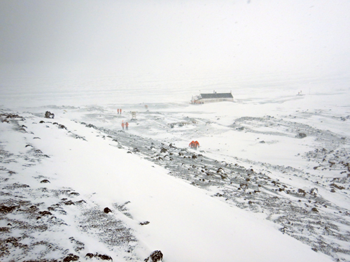
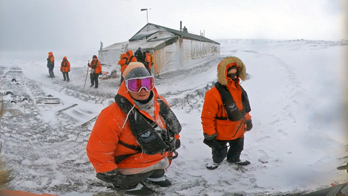
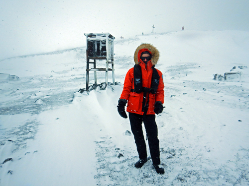
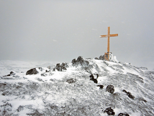
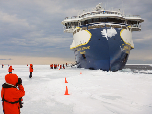
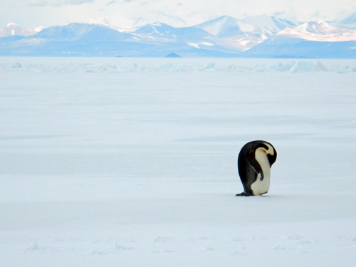
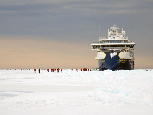
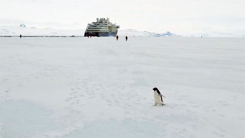
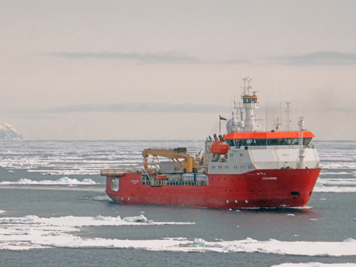
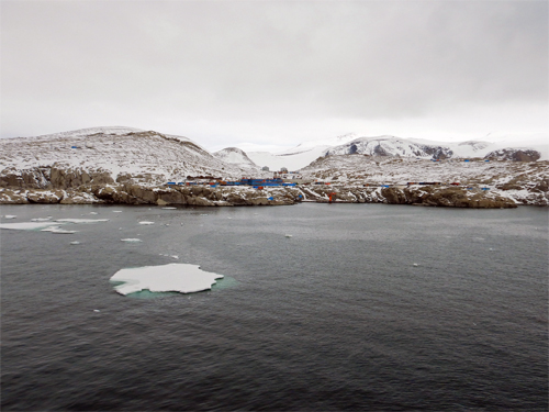
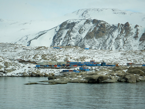
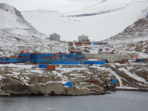
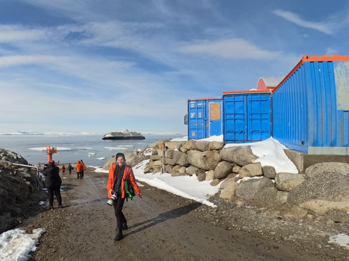
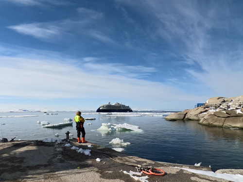
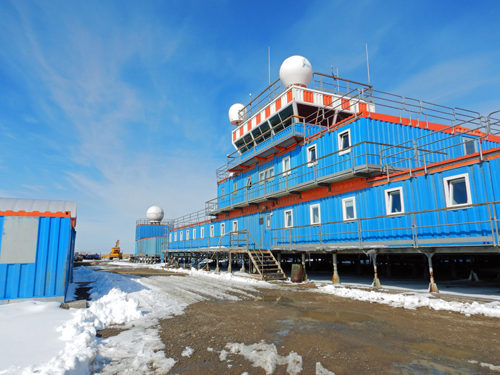
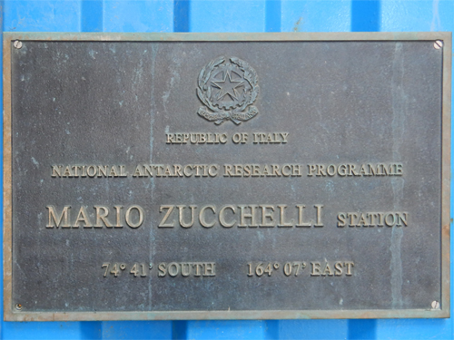
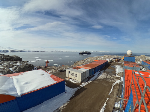
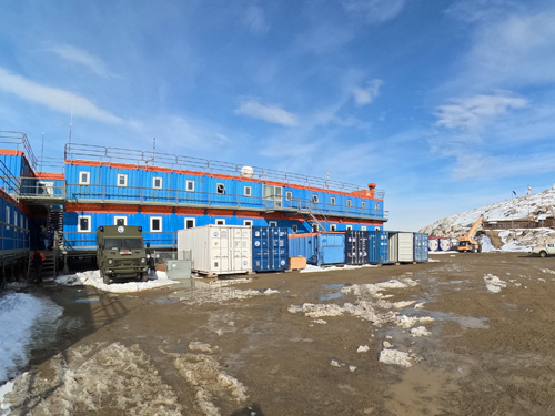
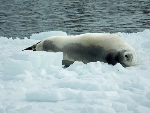
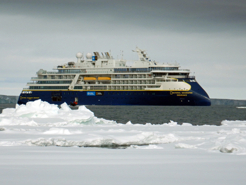
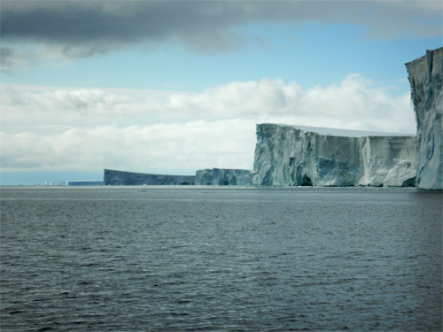
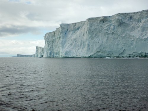
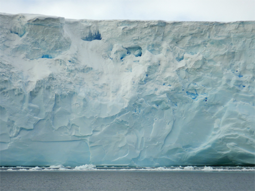
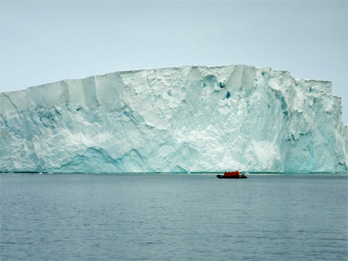
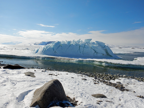
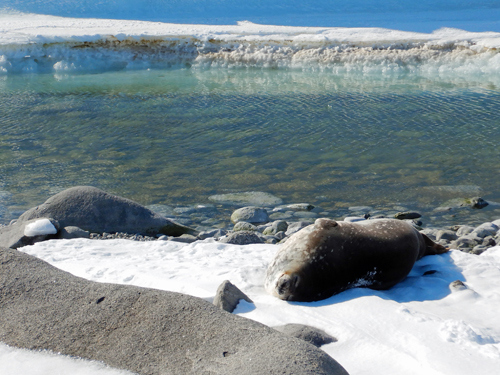
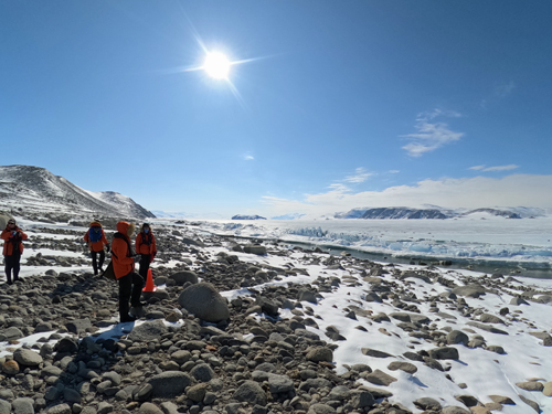
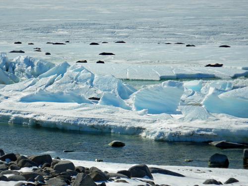
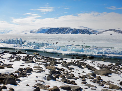
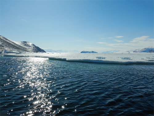
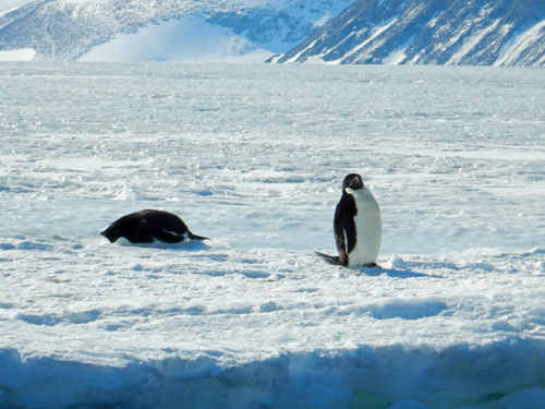
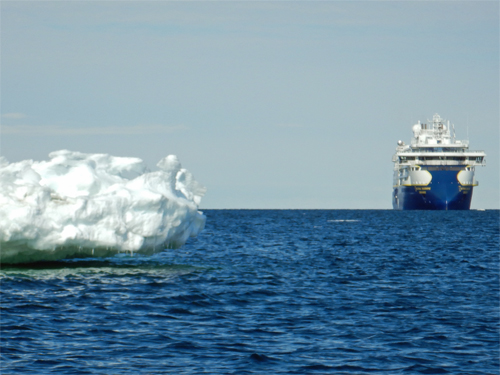
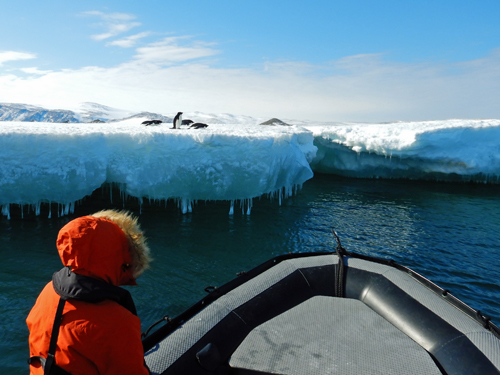
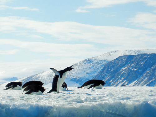
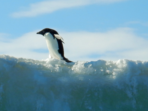
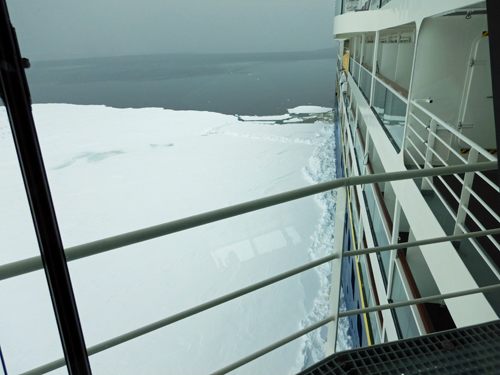
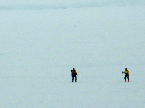
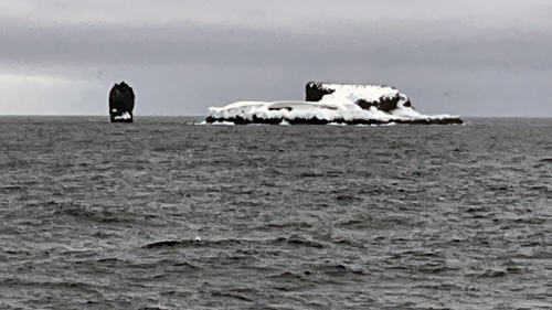
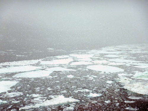
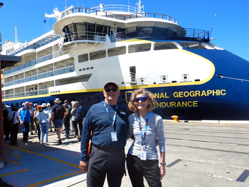
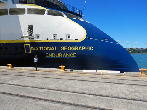
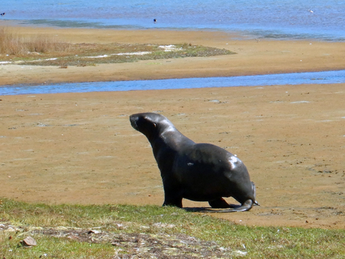
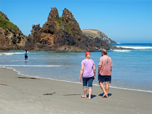
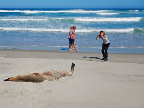
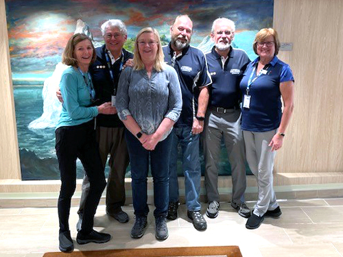
We visited the Antarctic Penninsula in 2018/2019 aboard the National Geographic Explorer. We enjoyed the trip but just got a taste of Antarctica. We did not get below the Antarctic Circle and did not see the deepest parts of Antarctica. We visited Iceland and East Greenland in the fall of 2023 aboard the National Geographic Endurance - a new Linblad Expeditions ship purpose-built for polar expeditions. This January we took the National Geographic Endurance on an Epic Antarctic Expedition. We left Ushuia, Argentina on December 30, 2023 and arrived in Dunedin, New Zealand on January 29, 2024. The expedition bypassed the upper Antarctic penninsula and made landfall on the lower penninsula. We went all along the Antarctic continent to the Ross Ice Shelf and McMurdo Sound. This was a planetary-scale expedition of roughly 6500 nautical miles - crossing many time zones and the international date line. We got as far south as is poossible on a ship and saw lots of ice, iceburgs, whales, seals, penguins, and birds. We visited some of the original Antarctic explorers huts and an Italian research base. We saw a lot of Antarctica and a part of the world few get to visit.
Click here to see the voyage portfolio put together by National Geographic. It includes daily expedition reports, staff biographics, and a guest slideshow of pictures contributed by our fellow guests on the expection.
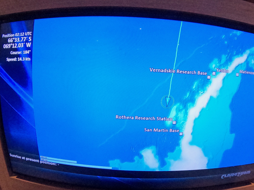
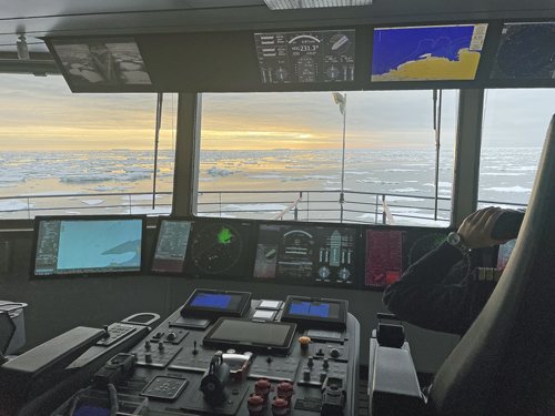
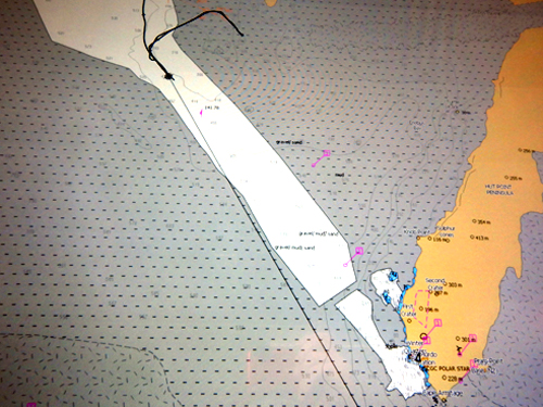
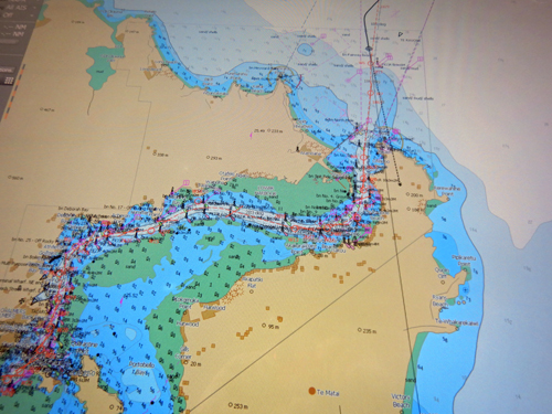
See below for the voyage map of our journey, compiled from the ship's navigation system, followed by a slideshow Care put together of her favorite slides throughout the trip. They are followed by a day by day journal of photographs and videos of our trip.
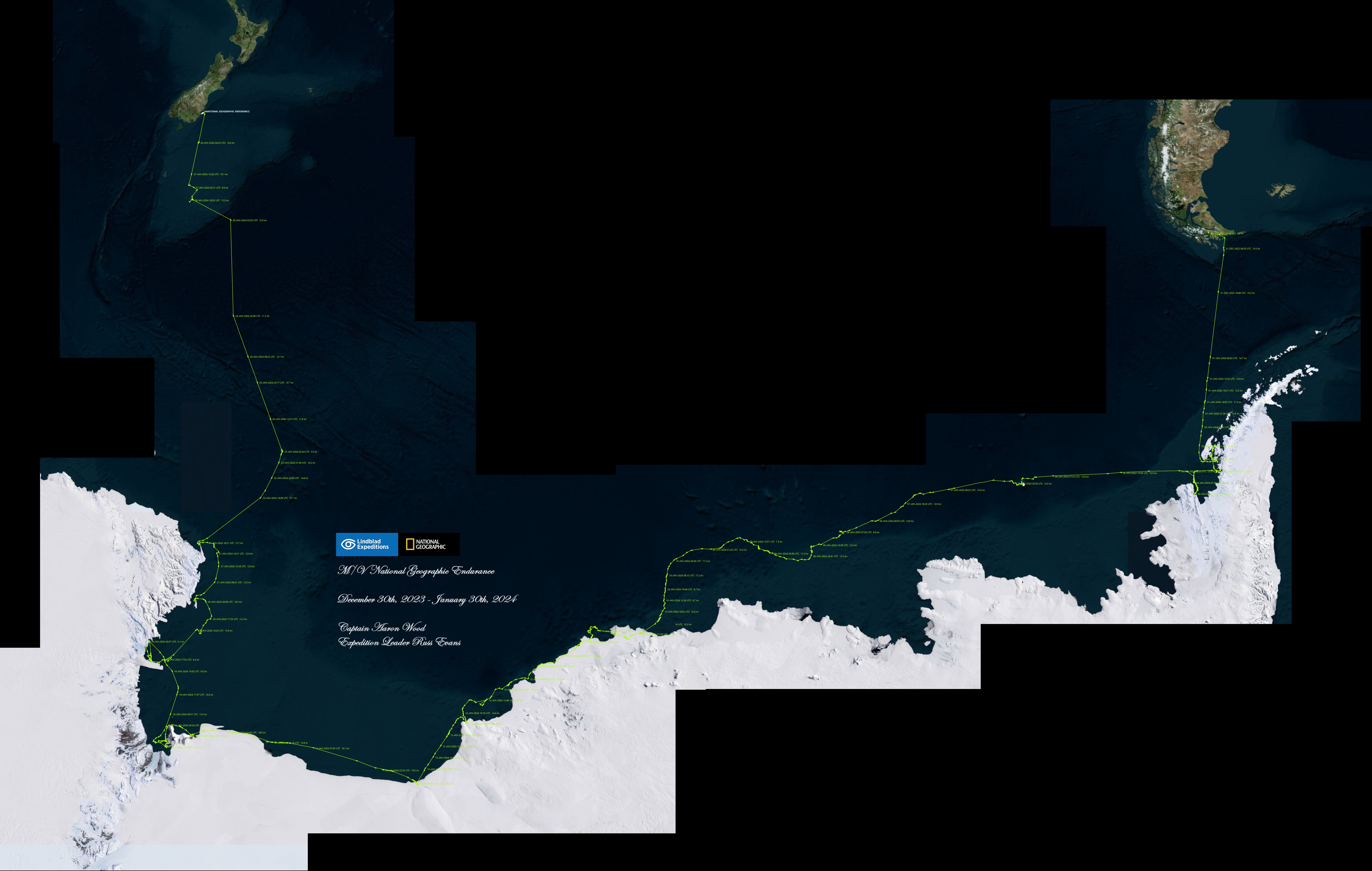
Voyage map courtesy National Geographic
Day 3 - January 1 - Drake Passage and the Antarctic Circle
We continued our second at-sea day across Drake Passage and down the edge of the Antarctic Penninsula - aiming for the elbow of the penninsula where it connects to the large Antarctic land mass. We have a number of briefings including biosecurity (there are very rigorous procedures to prevent introducing potentially hazardous organisms to Antarctica). We had the captain's welcome party and met Captain Aaron. Around 10:30 pm, we crossed the Antarctic Circle. We will remain below the Antarctic circle for about three weeks. As we moved south, we started to see icebergs - initially small and getting larger throughout the day. Here is the Daily Expedition Report and Care's Rizbee on the Road blog for Drakes Passage and the Antarctic Circle.
Day 4 - January 2 - Marguerite Bay and Horseshoe Island
Today was our first opportunity to get off the ship and our first time to set foot ashore in Antarctica. We kayaked around Marguerite Bay on a very sunny morning, getting to see iceburgs. It was a beautiful sunny day for kayaking. After our kayak trip, we went ashore on Horseshoe Island. Horseshoe Island was a research base established by the British in 1955. Its primary purpose was geological research. We got a chance to visit the research base hut which has been preserved. It gave us a glimpse of what life was like for those who lived and worked in Antarctica. In the afternoon, we cruised up "the gullet" but were unable to go far because of ice. On the way back, we passed the UK's Rothera Research Station. Follow the link and check out the drone video of the station. Here is the Daily Expedition Report and Care's Rizbee on the Road blog for Marguerite Bay and Horseshoe Island.
Day 5 - January 3 - Red Rock Ridge and Neny Fjord
This was our second day in Marguerite Bay and we went ashore on Red Rock Ridge to see an Adele penguin colony. It was breeding season so we saw (and smelled) lots of adults and chicks. In the afternoon, we did zodiak cruises in nearby Nedy Fjord and saw lots of crabeater seals. Some penguins were quite curious and followed us around and put on a show for us. Here is the Daily Expedition Report and Care's Rizbee on the Road blog for Red Rock Ridge and Neny Fjord.
Day 6 - January 4 - Alexander Island
Today we pushed through some sea ice to Alexander Island. It was very foggy in the morning so we could not get off the ship. In the afternoon, the fog cleared but it was overcast. We did some zodiak cruising and saw crabeater and Weddell seals as well as small groups of Adele penguins on the ice floes. I did get some underwater videos of the ice. Here is the Daily Expedition Report and Care's Rizbee on the Road blog for Alexander Island.
Day 7 - January 5 - Bellingshausen Sea
This was an at-sea day. We saw a number of presentations but there was nothing photogenic so no photos or videos for this day. Here is the Daily Expedition Report and Care's Rizbee on the Road blog for Bellingshauen Sea.
Day 8 - January 6 - Peter I Island
While crossing the Bellingshausen Sea, we stopped at Peter I Island, a remote island inhabited only by seabirds and seals, and claimed by Norway. It is volcano that rises 4000 meters (~12,000') from the sea floor and another 1600 meters (~4,800') above sea level. We landed on the island (a pretty exciting landing as the zodiak went up a rock face at a pretty extreme angle) and did a zodiak tour nearby. Here is the Daily Expedition Report and Care's Rizbee on the Road blog for Peter I Island.
Day 9 - January 7 - At Sea - Amundsen Sea
After leaving Peter I, we cruised across the Amundsen sea. We spotted a blue whale and lots of icebergs. The ship started to get into some ice crunching of its own - shown here in timelapse. Here is the Daily Expedition Report and Care's Rizbee on the Road blog for the Amundsen Sea.
Day 10 - January 8 - B22A
As we crossed the Amundsen Sea, we encountered B22A, a huge iceberg that broke off from an Antarctic glacier 20 years ago. It is about 43 miles long and 28 miles wide. We took about six hours to pass it - a huge piece of ice, Here is the Daily Expedition Report and Care's Rizbee on the Road blog for B22A.
Day 11 - January 9 - Amundsen Sea
This was another at-sea day as we headed toward Cape Burks. We saw a number of presentations and watched icebergs go by. Here is the Daily Expedition Report and Care's Rizbee on the Road blog for the Amundsen Sea.
Day 12 - January 10 - Cape Burks
We crashed through more ice overnight and cruised across more of the Amundsen Sea enroute to Cape Burks. In the afternoon we took a zodiak cruise through a bunch of small icebergs inhabited by Emperor and Adele penguins. Here is the Daily Expedition Report and Care's Rizbee on the Road blog for Cape Burks.
Day 13 - January 11 - Go with the flow
As we cruised through the Southern Ocean, we came upon a large flat piece of sea ice. The ship parked against the sea ice and held itself in place using engine power while we dropped a gangplank and went ashore in search of penguins and seals. This was our first excursion out onto the sea ice. The evening we held a special dinner celebration for a couple of our fellow guests who were celebratring their 50th wedding anniversary. In preparation for crossing the international date line, we set our calendars a day ahead from January 11th to January 13th. What happened to January 12th? Here is the Daily Expedition Report and Care's Rizbee on the Road blog for Go With The Flow.
Day 14 - January 13 - Cape Colbeck, Bartlett Inlet
We came along side some fast ice but had difficulty getting the ship into it. The crew opted to use zodiaks to shuttle us in the wind over to the fast ice, even though it was only a short distance. We went ashore in a lot of wind and blowing snow. We found some seals and curious Adelie penguins (why are Adelie penguins always curious?) Our ship's dive leader, Brett Garner, took some wonderful videos of a group of Emperor Pengins with some chicks (the round fuzzy balls). A group of Adelie penguins came over and pushed over the chicks. None of our naturalists aboard could explain this bizarre penguin behavior. That night, we had a wedding aboard. The weather was too fierce to do it outside so the ceremony was held in the yoga studio aboard the ship. Here is the Daily Expedition Report and Care's Rizbee on the Road blog for Cape Colbeck.
Snow Penguins video courtesy of Brett M. Garner, National Geographic. Used by permission.
Day 15 - January 14 - Bay of Whales
We reached the farthest south point of our expedition (78˚38.744 S x 163˚33.489 W) and the farthest south point in the world reachable by ship. We cruised along the fast ice along the Ross Ice Shelf, starting in the Bay of Whales. It was too windy for zodiak cruising so we just observed from the ship. I mounted a GoPro Hero12 to the bow of the ship using a gumby mount and shot a timelapse video as we cruised along the shelf. It is hypnotic. The video shows moving from flat fast ice to the vertical edge of the ice shelf. For dinner, we had the multi-course Shackleton's Tasting Journey - a special meal prepared by the dining staff where each dish celebrated something from Shackleton's explorations. Here is the Daily Expedition Report and Care's Rizbee on the Road blog for Bay of Whales.
Day 16 - January 15 - Ross Ice Shelf, Cape Crozier
This was a beautiful and sunny day at Cape Crozier along the edge of the Ross Ice Shelf. We had a spectacular morning view of Mt. Terror, one of two large mountains on Ross Island. In the afternoon, we did some zodiak cruising and saw lots of Adele penguins. Later in the afternoon, 49 of our shipmates braved the cold water and did a polar plunge. We passed on that activity but I did get an honorary polar plunge patch for an involunary polar plunge at Coulman Island a few days later. Here is the Daily Expedition Report and Care's Rizbee on the Road blog for Cape Crozier.
Day 17 - January 16 - Cape Royds
We went ashore on very slick ice to hike about 1¼ miles to Shackleton's hut. It was pretty interesting to see where and how 14 men, 15 ponies and 9 dogs lived in the tiny hut over the Antarctic winter. We had go in stages because only a small number of people are allowed in Shackleton's hut at any one time and we had to take an indirect route to avoid a penguin colony. Our crew mapped out a route using orange cones. Our of nowhere, curious Adele penguins showed up looking perplexed as to who we were and what we were doing there. On the way back, an Antarctic white-out storm swept in, and visibility went to zero. Fortunately, one of our naturalists had a GPS to help us navigate back to the ship. The winds were so fierce that Care had trouble standing and walking. We could not see the ship until we were almost upon it. The white-out only lasted a few minutes but could have lasted for days. It was a classic Antarctic experience. Here is the Daily Expedition Report and Care's Rizbee on the Road blog for Cape Royds.
Day 18 - January 17 - Cape Evans
We awoke to a snow storm and found the ship embedded (on purpose) in the pack ice to ride it out. In the afternoon, we relocated the ship to visit Scott's Hut from the Terra Nova expedition. We went ashore in a storm and hiked the short distance across the ice to the hut. In the afternoon, after returning to the ship, we had a tour hosted by our executive chef behind the scenes to see the kitchens and food storage areas. Here is the Daily Expedition Report and Care's Rizbee on the Road blog for Cape Evans.
Day 19 - January 18 - McMurdo Sound
We got very close (~10 miles) to McMurdo Station, but the ice breaker opening a channel for them to get supplies did not get the channel open enough for us. We could see some windmills and radar domes at the station but we could not get to it. McMurdo is on hte lower right of the chart below and the ship's position os the dark dot in the upper left. Instead we trekked out on the sea ice and saw some cool penguins, including a molting emperor penguin. In the afternoon, we took to the zodiaks in hunt of killer whales. We Here is the Daily Expedition Report and Care's Rizbee on the Road blog for McMurdo Sound.
Day 20 - January 19 - Terra Nova Bay and Zuchelli Station
We headed north from McMurdo sound to Terra Nova bay. One the way we saw the first ship we had seen since leaving the Antarctic Penninsula. The Laura Bassi is an Italian research ship. It serves the Mario Zuchelli Station - and Italian antarctic research station. Upon reaching Terra Nova Bay, we went ashore to tour the station. They were operating with a skelton crew, getting ready to shut down for the winter but were very hospitable with lectures describing their work and some delicious Italian coffee and pasteries. Here is the Daily Expedition Report and Care's Rizbee on the Road blog for Terra Nova Bay and Zuchelli Station.
Day 21 - January 20 - Drygalski Ice Tongue
We explored by zodiak the Drygalski Ice Tongue, a 43 mile tongue of ice that sticks out from McMurdo Sound. We then went to Cape Russell on Inexpressible Island. The weather was spectacular and we encountered beautiful scenery and abundant wildlife. Here is the Daily Expedition Report and Care's Rizbee on the Road blog for the Drygalski Ice Tongue.
Day 22 - January 21 - Coulman Island
This started off as a quiet morning at sea. After lunch, the ship embedded in the pack ice - about 3-4' thick with a couple of feet of snow. I was talking with one of the officers on the bridge and noticed that he was keeping power on the engines to hold us in place in the ice. Our expedition leaders went out to test the ice and deemed it safe for us to go out and explore. I initially tried cross country skis but found them too difficult (it has been about 30 years since I XC skiied), so I switched to snow shoes. I was walking along a well-worn track when my snow shoe plunged through the snow crust and landed on the ice. A pain to get out, but not impossible. But then, the ice below me gave way and I plunged into the water. I called for help from guests nearby. One woman came to my aid but the ice started breaking up around her. She summoned more help and other guests arrived who helped pull me out of the water with my ski poles. I was in the water for 5-10 minutes. It was very cold but mostly I was focused on problem solving to get out. I was wearing a 360 go pro and captured the whole thing. The video on the left is a 360 video of the whole trek (plunge begins at ~1:20) and the right is a key-framed video of the plunge itself. My camera fell off as I was getting out of the water but someone picked it up and gave it back to me - it was still recording. Our expedition guides later told me that the weak spot in the ice was made by seals chipping at the underside of the ice to make a breathing hole. They awarded me an honorary polar plunge patch. I told them I was the only one to do a polar plunge without signing a liability waiver. Here is the Daily Expedition Report and Care's Rizbee on the Road blog for Coulman Island.
Day 23 - January 22 - Cape Adare
Cape Adare was one of the highlights of the trip and our last stop in Antarctica. It featured an Adele Penguin colony with over 500,000 breeding pairs. That meant that we were in the midst of literally 1,000,000 penguins. We were going to try to go ashore at research hut built by Carsten Borchegrevink – oldest structure in Antarctica - but the ice on shore was too thick and too many penguins to be able to get to the hut. Instead, we did an incredible zodiac cruise amongst the penguins and saw lots of amazing penguins and penguin behavior. Our youngest guest, the captain's son, did donuts in one of the zodiaks - with the ship in the background. Here is the Daily Expedition Report and Care's Rizbee on the Road blog for Cape Adare
Day 24 - January 23 - Scott Island
after we left Cape Adare, we started heading north toward New Zealand. We were supposed to visit MacQuarie Island, but Australia would not issue permits for us to land. We also had plans to visit the New Zealand Subantarctic Islands but a combination of bad weather and engine troubles kept us from landing there. Instead we headed north through some, at times, very rough seas. The only land we saw was a small outcropping called Scott Island, otherwise - until we reached New Zealand - it was just open water. At times it was too rough to do much of anything. The outer decks were closed and it was too dangerous to work out in the gym. We did entertain ourselves with a nunmber of activities on board including a crew talent show and some below decks tours. Here is the Daily Expedition Report and Care's Rizbee on the Road blog for Scott Island
Day 29,30 - January 28,29 - Dunedin
After several days of rough seas and cold rain, the sun came out and it started to get warmer. We were approaching New Zealand, where it was summer. As we approached Dunedin, the harbor pilot came aboard and guided us through the channel to our berth. We actually arrived a day early because we had some engine trouble and were making for port as a precautionary measure. We toured Dunedin, which is a nice little town - with the world's steepest street, and went to Allen's Beach to check out the local wildlife. It was nice being in warmer weather (and green) but sad to say goodbye to the ship and our travelling companions of a month. Here is the Daily Expedition Report for Dunedin.
Day 31- January 30 - Aukland
We flew from Dunedin to Aukland to end our expedition. We stayed in Aukland one night and explored the nearby parks, as well as a cultural presentation at the local museum. It was positively balmy in Aukland. Quite the contrast to our frosty January.